I didn't know how behind I was...
I still need to at least put up pictures from hiking Targhee for mountain biking, pictures for day 1 of ski season (hiking Targhee for snowboarding), talk about the metal concert, Seattle, and riding in Bellingham.
I hiked Targhee with a mountain bike on two occasions after the lifts closed. The first was with Chris, and we wanted to ride the new sticks and stones which I had gone through after the last rain and tamped, smoothed, and perfected. I knew it was going to be prime, and it was.
Here's Chris hiking up the connector with the Tetons in the background.
This is Mary's Nipple to the left (also visible above), Mary's Saddle in the middle, and then Peaked mountain (pronounced Peak-Ed) on the right. The mountain bike trails are in the basin between me and the base of Mary's or so.
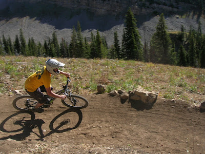
Here I am coming down the rock turn about 1/3 down the new Sticks 'n Stones.
Here's Chris leaning into the biggest, baddest berm on the mountain (I'm proud of our work on this one):
Here's another view of the berm. It ends in a lip that transfers you down the hill. Much to my pleasure, it rides nice. This was the first time I built a lip on the end of a berm, and I was worried it wasn't going to work out right, but I stuck with my gut instinct on the line and BAM!
It's amazing how much I learned about building trails from the practice I got this summer. I see trails completely differently now. I understand how the bike interacts with the trail much, much better, and I know what is needed to build sustainable trails. I also know how important it is to do things like remove vegetation BEFORE you build a feature (something the crew was not good at and made more work for me). In my spare time I think I'm going to sit down with a pencil and a piece of paper and try to come up with a more scientific approach to modeling mountain bike trails. I think by treating the tread surface as a tube (inspired by mariocart for Wii) you can get a good idea of what sort of trail/berm lines will ride with flow. There have to be a lot of variables, too: rider velocity, line selection, other trail features, and personal preference all play a big role in trail flow, but there has to be an underlying principle that makes a trail flow, where in this case we're talking Andy Williams style lines (lots of turns). What I want to know is this: can I mathematically back up what I believe makes the perfect entrance and exit (allowing the rider to carry speed) for an Andy Williams style bermed turn?
Uh...tangent.
Here's chris hitting another feature I'm proud of, but this is part of the reason my finger joints hurt. It's a rock lip that steps up over a bunch of rock pavers. You can go around to the left, ride straight over the lip, or hit the jump. So far the gap is good. It's totally case friendly as long as you don't plow your nose into it, and if you hit it just right the landing is mostly rock. The gap is about 8 feet at the most.
Basically we ended trailbuilding on a high note for me at least--building a fun intermediate level feature filled trail.
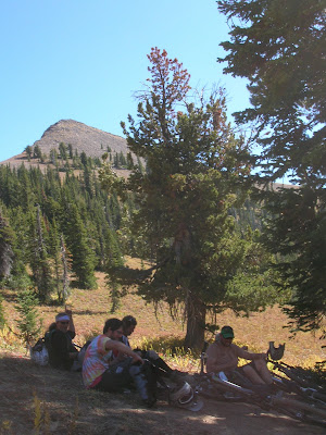
OK moving on. About a week later we hiked with just about the whole crew: Me, Chris, Zach, Taylor, Dippy, and Michael. Fall colors!
Dippy coming into the berm:
Chris airing it out
I dunno why everything is underlined... It's bugging me, and I can't figure out how to turn it off. You'd think I'd know this by now...
We had a great run, and it would be our last.


No comments:
Post a Comment